Live Classes
The Joshimath collapse is a warning sign.
The subsidence of land in Joshimath, the gateway to several places of pilgrimage and skiing destination Auli, may have been triggered by the unscientifically planned developmental works in its vicinity, but its genesis lies in the indiscriminate anthropogenic activities inimical to the ecologically sensitive and geologically fragile Himalayan region.
Why Concern?
In fact, this incident needs to be viewed as a warning sign for such calamities to happen more frequently and at more places in future. Though almost the entire Himalayan terrain is prone to landslides, Uttarakhand, being located in the seismically most active Zone V, is particularly vulnerable because most of its territory is formed by weak and unstable rocks.
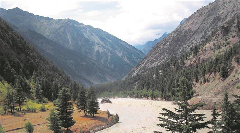
Joshimath City And Disaster
Joshimath town itself is located on the debris generated by the landslide that occurred in the aftermath of the melting of a glacier in the 19th century. This fact was reported in the Himalayan Gazetteer way back in 1886, and it had also minced no words in stating that the place was unfit for large human habitation.
A committee headed by M C Mishra, Garhwal commissioner in the 1960s, had warned about a possible sinking of Joshimath land in its report presented in 1976. Even in recent years, experts have been sounding alarm bells concerning unplanned expansion in Joshimath, proliferation of its population, and the rise in the number of tourists beyond its carrying capacity. None of these warnings has been heeded. Another natural phenomenon that has not received the attention it merits is that Uttarakhand is beset with the constant menace of water percolation, which reduces the cohesive strength of the rocks.
The present episode of land sinking in Joshimath was also preceded by a sudden gushing of water and other signs that were disregarded by the authorities. Although almost all developmental activities have now been put on hold pending the availability of more reliable information on the geological instability of the region through scientific studies, experts believe that considerable irreversible damage has been done. They are also of the opinion that ongoing works like the Tapovan hydropower plant or the construction of the Char Dham road between Helang and Marwari are not the only projects that can be blamed for the present tragedy. There has been an unprecedented spree of infrastructure development activities going on for years, disturbing the ecological, geological, and hydrological equilibrium of this disaster-prone hilly region.
What Should Be Done ?
This apart, the need for being extra cautious in planning infrastructure and other development projects in the Himalayas has now increased also because of diminishing snow cover and glaciers due to climate change and intensified human activities. A recent study has shown the Himalayas and the Tibet Plateau have witnessed accelerated warming at a rate of 0.2 degrees Celsius per decade since the 1950s. This has added to the pace of glacier melting, further disturbing the hydrological balance, besides altering the course of water streams and increasing sedimentation.
There are around 900 glaciers, covering nearly 2,850 square kilometres, in the Uttarakhand section of the Himalayas alone, and they are subject to rapid erosion. What needs to be realised is that the Himalayas, unlike most other mountain ranges that consist of stable hills, are still undergoing the process of evolution and, therefore, require special attention. Any disregard of this would invite more perils of the kind being witnessed in Joshimath.
What is land subsidence?
According to the National Oceanic and Atmospheric Administration (NOAA) , subsidence is the “sinking of the ground because of underground material movement”. It can happen for a host of reasons, man-made or natural, such as the removal of water, oil, or natural resources, along with mining activities. Earthquakes, soil erosion, and soil compaction are also some of the well-known causes of subsidence. This phenomenon can “happen over very large areas like whole states or provinces, or very small areas like the corner of yard.”
What is landslide?
'Landslide' refers to such a geological phenomenon, in which any part of the land or land block starts sliding downwards in the form of debris due to the effect of slope gradient or earth's gravity. Landslides can range from the falling of small boulders to the sliding of large rocks.
About Joshimath
Why is Joshimath sinking?
MC Mishra Committee Report
Download pdf to Read More